June 27, 2025 - 5 Tornadoes in North Dakota!
- GK Naill

- Jun 27, 2025
- 4 min read
Updated: May 21
We noticed that some severe potential was developing in North Dakota, and we eventually decided to go out for a chase. This was likely going to be one of the last major chases of the season.
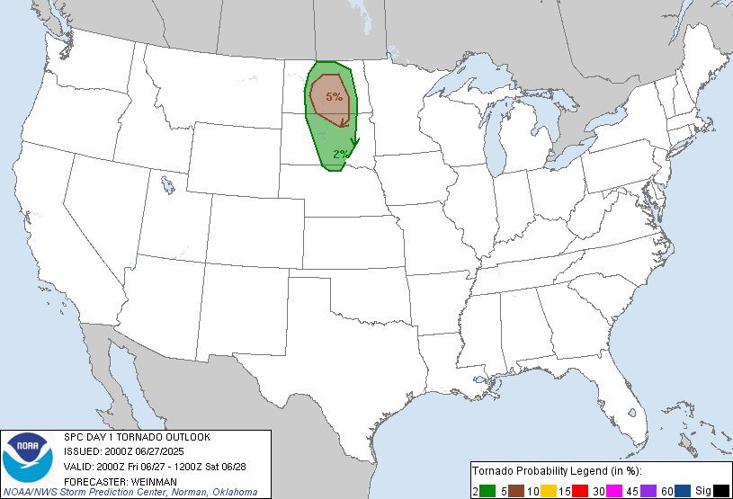
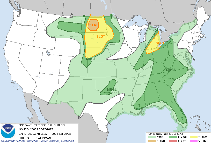
The SPC originally had it as a SLIGHT risk, but they upgraded it the day of to an ENHANCED (3/5) risk, with a 5% TOR.
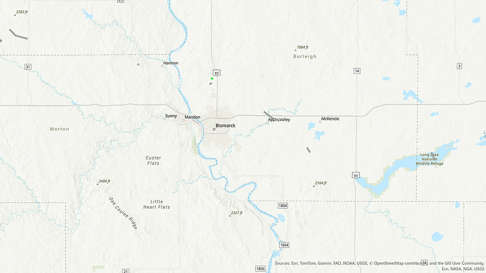
Tornado 1 - Mandan/Bismarck, ND
After way too many hours of driving, we finally got close. There was a large cumulus field to our northwest, and we knew that if any of them could break the cap, we would get a beautiful storm. However, we didn't expect it to be this beautiful.
As we got close, a supercell was strengthening and matured to our west. It dropped a tornado, but we were too far to see it. But we eventually caught up to the storm, and we were in the perfect position.

The base of the storm was completely clear, and the environment was beautiful. The ground was slightly hidden by some hills in the foreground, but we saw something poking out from the storm base. And as it grew, it began to spin. We had a funnel.
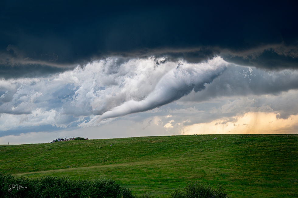
The funnel snaked from the cloud and turned into a photogenic elephant's trunk. Then... touchdown. The tornado lasted about 5-10 minutes and remained mostly stationary. I grabbed my camera and took pictures, but because obviously, I forgot to hit record on the rest of my cameras (and don't forget about the smudge on my lens!). Because of the hills, we couldn't see the debris cloud, but reports from other chasers reported that it was on the ground. It was rated an EF-U by the NWS.
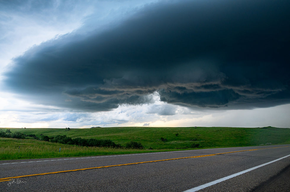
As the tornado dissipated, the storm moved and displayed its beautiful clear slot to us. The storm moved north of Bismarck, and we followed it. Eventually, we pulled over on the side of the road and watched it. It didn't produce again, but eventually we got to the south of Menoken, ND, and sat there.

Tornadoes 2-5 - Bismarck/Menoken, ND
As we sat in Menoken, everyone else was watching the old storm. There was a tornado report, but we didn't see it, so we didn't count it.
While everyone else was watching the old storm, the new storm that formed to our west caught my eye. And I was damn sure glad it did. In the distance, there was a lowering. And 2 back-to-back tornadoes touched down near Bismarck. 1 EF1 and 1 EFU. We could see parts of it, but we were too far away to capture enough detail of the tornado. We saw it, and that's what counts.

The storm approached our location, and we kept watch. Then, it strengthened, and we got a tornado warning. It was night out at this point, so we couldn't see too much. But with my camera in hand, I attempted a photo to see some detail.

The original photo was almost completely dark. However, increasing exposure in Lightroom revealed the silhouette of the 4th tornado of the day. We then got out of the car and tried to take more photos of the tornado.

Eventually, that tornado dissipated, and the storm was starting to jut out high winds and hail towards our area, so we adjusted our position. That tornado was given an EFU rating. After adjusting the position, we looked out the back window and saw the 5th tornado of the day. Yet another EFU! It wasn't crazy long-lived, and it was approaching midnight, so we decided to head back into Bismarck and celebrate with the classic: midnight pancakes at IHOP.
However, all good things must come to an end.
Wait, What About Gary, SD?
After our midnight pancakes, we went to the hotel we booked. We arrived and were told we had been overbooked. 4 people, 3 adults and a 10-year-old, with all of our stuff. We couldn't sleep in a Prius!
We had to sit in the hotel for a while, and eventually we got a room - we got upgraded to a suite! With only 1 bed. 4 people, one bed. But the room had a pull-out couch! With no mattress. We had to go and get the mattress and the sheets, and I decided to sleep on the couch. The mattress was basically just a sheet of paper, with no cushioning, and I could feel every spring under my back. I think I finally fell asleep at around 3 in the morning.
We woke up at 10 AM, still tired, and didn't think to check any models for our outlooks. But we went to IHOP again! I walk in, sit down, and I feel something on my arm. I somehow got a tick at 10 AM while walking into IHOP. It wasn't attached and (thankfully) didn't bite me yet, but it took you until now?
We finally get moving around noon. Then we missed the tornado in Gary, SD. We missed it because we had stuff we had to do (because we're humans, you know?), so we had our short grieving period, then we got to the hotel for the next night, because we weren't about to show up at home at 5 in the morning!
Storms were hitting the hotel almost all night. And whenever there are storms, I'm just not tired. Great while chasing, not so much when I'm trying to sleep! I eventually fall asleep, then we get up in the morning, and I left one of my AirPods in the hotel room. The hotel found it... and just refused to ship it to us?
Conclusion
Forgetting about my whole rant there, this chase was a very successful chase. We saw 5 tornadoes in 1 day, all of them being photogenic, causing minimal damage and injuries.
Comments